 The weather was good. The high pressure in the Atlantic was holding a cold front to the north and the associated clouds could not quite reach Atlanta. Few to scattered at 6000ft with a slight chance of thunder-bumpers in the afternoon, winds were calm and mostly out of the west.
Objectives of this flight: practice enroute procedures.
I got to the airport about 7:00 (L), picked up the dispatch kit and went out to the airplane. Panel lights were still squawked as inop. Normal preflight and start, but an annoying back-tone on Comm 1. (I played with the various volume controls/squelch adjustments and finally eliminated it after I accidentally pulled off and replaced the button on the GNS430.) As I was doing my runup a beautiful RV9(?) made a low pass. He was clearly having some fun as he pulled nearly vertical to enter a left downwind.
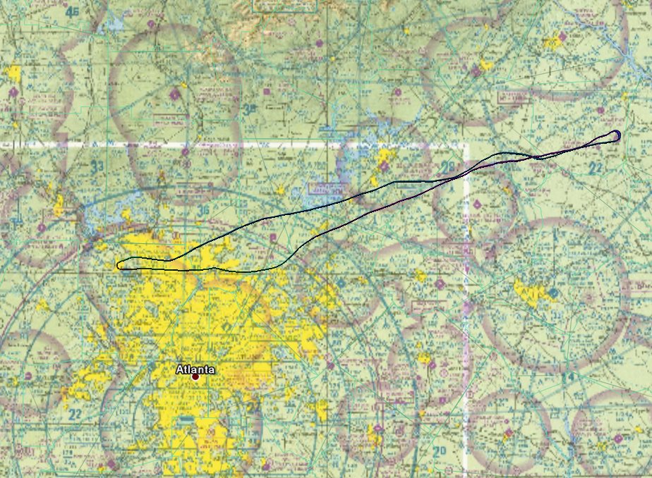
Take off and climbout were normal. I climbed to 3500 completed my cockpit checks and prepared for my "x-country". The GNS was set for 'track up' instead of my preference for 'north up', which I quickly changed with the menu button. I always keep a log of important data I'll use along the route. For this flight I wanted to replace a lot of that information by using the GNS430. Instead of writing down all of the CTAF/Unicom/Tower frequencies, I wanted to use the Nearest/Airport page to pull them up as required. This worked well. It turned out to be very convenient and less prone to error.
I am not pleased with fuel management procedures in this airplane. I can lean the engine by looking at the RPM, but GPH is only a guestimate from the POH. So it looks to me like you do the plan, then stay way conservative with the GPH calculations.
I seldom play with the autopilot, since I have had less then stellar results. This one proved to be no exception. The "wing leveler" had a very annoying oscillation as it constantly tried to hold a heading. I put Electric City (ELW) in the Nav2 VOR and tried to use it to track there, but had the same poor results. No heading bug, no real tracking mechanism meant it is pretty much useless. I wouldn't trust it in actual IMC.
After my problem with the flaky directional gyro, I wanted to play with the vertical compass card on the GNS430 (Nav/page 3) and was pleasantly surprised. Not only does it provide the simulated DG, but also has the pretty purple line showing where your track is in relation to the airplane. Very nice.
There is nothing out in North East Georgia, unless you like poultry farms. I arrived at 18A about 8:30 made my turn, climbed to 4500 and headed for home. This part of the trip was pretty uneventful. I put direct-to KRYY in the GNS430, selected vectors to the ILS27, activated it, and got lined up for a straight in about a gazillion miles out. (The only mistake I made was calling 10 miles out, when I was actually 10 miles from AKONE.) I was little high/fast on final, but acceptable for a night landing. I made a nice touchdown.
 AA5B
AA5BTime = 1.9
*I downloaded a new patch for my handheld. Unfortunately my "Flightbook" software fails to accept any data from the new level of code. No stats until/if I can get this glitch fixed.
2 comments:
Hey Dave, I fly out of KGVL. Got my IFR ticket a few years ago flying out of 47A (Randall Simmons FS, closed now). If you need a safety pilot, give me a holler.
Thanks for the offer! What kind of A/C do you fly? KGVL looks like a realy pretty place and should be very easy to link up for some safety pilot work.
Post a Comment