Friday, March 17, 2006

Just Practice Approaches


My flying partner put together a list of objectives to consider when planning our flights. He summed it up this way:
So we have three categories of flying:
I. Fun Cross Country
II. Instrument Approach Hopping
III.Busy Cross Country with Instrument Approaches.
After the serpentine approach I flew last week into KPLR, I decided I really need to work on II. The objectives of this flight were 1) basic airwork and 2) simulated instrument approaches.

We both arrived at the airport at 4:00pm local, after a rather stressful day at work. Conference calls, email, phonemail and powerpoint presentations were still unanswered and incomplete, and I was weary from the confrontations and compromises made throughout the week. I sensed he felt about the same. However, there is just something refreshing about preflighting an airplane on a beautiful Springtime afternoon that helps to melt the real world away.

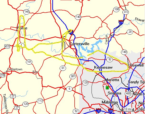
The plan was for him to take the first leg, do the ILS at KRMG to a low approach, then the ARC/GPS at C22 to a full stop. There we could switch seats and I would take us east to 47A for a GPS low approach, and finally vectors for the ILS back home to KRYY. Nothing new here, we had both flown these approaches before. Weather was not predicted to be a factor.

Preflight was normal except for one point. The plane had just come back from a previous flight, and when I checked the oil it was down around 4. I had another quart put in. I was told that I should have considered that there was still oil in the engine and that this was probably an overfill. Well, maybe. It may have put me over 6, but definitely under 7.

Taxi, runup and takeoff were all normal. He had his foggles on before passing 2000 and climbed on course to 4500. There was a broken level above us at about 8000, little bumps in the air and smog/smoke drifting in from the west. We also had an annoying 'tornado' in the airplane due to fact that we couldn't close an air vent.

His first chore was to track inbound to the VOR, then enter holding for the procedural turn. Rome isn't that far away from Cobb County, so he was kept busy with checklists and instrument procedures while I looked for traffic and checked in with the other folks using the VOR and landing pattern. He got a little behind the airplane trying to do his 'Ts' and 'AMICEATM' but overall flew a pretty good approach down to mins. We could have made the landing.

Missed there (carefully watching for cross traffic) and climbed back to the VOR. Opposing traffic was inbound to the field and the smoky haze made seeing him difficult. We passed well clear, no factor. Next setup was for the GPS into Centre Municipal in Alabama. The IAF happens to be about a mile Southeast of Cedartown, so I was glad for the silence on CTAF. I didn't want to be in the middle of a shower of Skydivers.

He used the GPS as primary and backed it up with the VOR. The arc went very well and he rolled out nicely on course. As we traveled the 15 miles to the airport, we both noticed a discrepancy in the needles. The VOR had us right of course, while the GPS had us dead on. I advised him to stay with his primary. Haze obscured the field until about 5 miles and at that point I knew that the VOR was giving a better indication. (I would have expected the GPS to be more accurate.) When he took the foggles off at mins he was forced to do some "fancy footwork" to set up for the landing. He concluded with a nice landing.

Time = 1.5
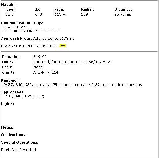
C22 is just a little field about a half mile from nowhere. Nestled away just on the other side of Weiss Reservoir, its the home of about a half dozen airplanes and is (I believe) a rest stop for the local arm of the airborne State Patrol. An old building with a head and not mush else. Sprint service was not available.

We stretched our legs and switched positions (headsets, flight bags, etc.) and I got my foggles and approach plates ready. My copilot checked the oil, seemed to be OK. So we jumped in and started her up. Everything looked good so I made the call to back taxi on 27. This was something new for me as I haven't had many opportunities to take off from small fields like this in a long time. It was only after I had gotten to mid field that I thought about the run up. Hmm. Well, I took position and just did a 'quick' run up before takeoff. No other traffic around so this was probably OK, but in the future I'll do it before taking the active. Also, doing anything 'quick' requires extra vigilance. It opens up all sorts of opportunities to miss things.

Takeoff and climb out on course normal. Local brush fires only made the haze worse, but we were flying east now so the visibility wasn't quite so bad. I leveled at 3500 direct to the RMG VOR. That acts as a feeder fix for the GPS RWY 4 Cherokee County. Airwork and procedures were good. I really felt "on" with enroute procedures and airwork. Maybe a minor 'flub' or two enroute on the radios, but overall I flew up to my standards.

The approach went well, although my copliot thought I was a bit high on final. It was hard for me to tell as I had foggles on and by now it was night time. He told me that the '5 clicks' worked and as I neared the final waypoint I executed the missed. I was very comfortable with course control.

Next task was to prepare for the ILS at RYY. I climbed up to 3000, roughly heading East and dialed up Comm 1 to talk to ATC. We were assigned a squawk and told to fly south while he tried to find us. AMICETAM complete, radar contact and vectors to the final approach course. However he allowed us to pass through the localizer before the final vector to intercept. This is when having a GPS is so helpful for situational awareness. We both caught it, but it was great to have it confirmed by the 430. Just as I was approaching the FAF he called to have us turn north to allow closing jet traffic to pass. Actually this was good news since I wanted to fly this one on speed rather then sprint down the glideslope. Vectors back around and we were once again ready to go.

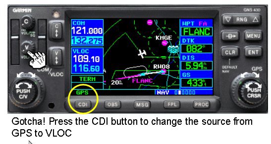
This was one of those few times when I was 'wired' to the gauges. The needles were dead centered on the donut, speed was good and rate of descent was just about 500 fpm. Corrections were minor and seldom did I get outside the ring...until about 500 feet above DH. Bing(1), the course needle jump about 3 points to the right! This was NOT me! Copilot said he was watching the airplane move left of centerline, but the needle was dead on centered until the jump. I made the correction, completed the checklists and made an 'OK' night landing.

Back at the school we asked a CFII about it, and he verified that I had VLOC selected, no red flags, etc. We'll play with it now to see if it can be reproduced. The good news here is that I'm very comfortable it wasn't my airmanship.
C172p
Time = 1.3

This was a big confidence builder. Airmanship is getting back to where it should be, procedures are becoming natural. I Still have a way to go, and am learning more about 'practical' flying every flight, but I'm finally comfortable.

*Good news: I learned that there is a good chance that a Tiger will be back in the fleet soon! While I have learned to enjoy the 'high wing wonder' I'm anxious to get back into a Grumman.

Saturday, March 11, 2006

Pell City, Alabama

The objectives of this flight: 1) enroute IFR procedures, 2) non-precision approach, and 3) that $100 Hamburger.

It looked like the planets had aligned and weather gods had finally agreed to allow us to venture west to Pell City (KPLR) in St Clair County, Alabama! While we had originally scheduled the airplane for 9:00 am local, we decided to wait for the remains of the windy cold front to completely pass and rescheduled for 3:00 pm. I arrived about an hour early so we could brief and do a final weather check. I had filed IFR from home (still very cool, although the AOPA Real-Time Flight Planner was down due to a Jeppesen server problem). The weather was very clear and not an issue. I decided to exercise some cockpit management and asked the Safety Pilot if he would handle all communications during the flight. (Since he is working toward his IFR rating it would give him some experience talking to the controllers, and with some reservations, he agreed.)

I filed Dalas/V325/GAD/STAMP/KPLR which uses STAMP as the feeder fix for the GPS RWY 20 into Pell City. I warned the copilot to expect HEFIN with V321 up to GAD and that was what was given. Clearance Delivery warned us of an annoying whine on our radio, and without missing a beat my copilot said he would tell "the pilot to keep it down". Earned him a chuckle from them and a snarl from me. Runup and take off went fine, although it took a little longer then normal for Tower to hand us off to ATC. Level at 6000 we were getting bounced around a bit, so I had the copilot ask for 8000, which is pretty high for this old bird, but she was able to maintain a 500 fpm rate. It was smooth at 8k and just about above the scattered layer. It was fun to slice a few of the wisps up there. We were cleared "our own navigation" direct GAD. We passed about 10 miles south of Cedartown (4A4) and heard the "getting ready to unload" message from the Sky Divers there. (Maybe Nate?)

During the climb my copilot suggested that I lean the mixture. I have always left that as an item on the cruise checklist, but he does it during the climb. What is the best practice here?

My enroute airwork was OK, but not as crisp as I would like. At one point I got 200 ft low, unexceptable, but overall the trip out was fine. I had some time to play with the autopilot, and it did well in both Navigation and Heading modes, although I kept my eye on it closely and it didn't behave as well as I would like passing waypoints. (Seemed to initiate the turns late.)

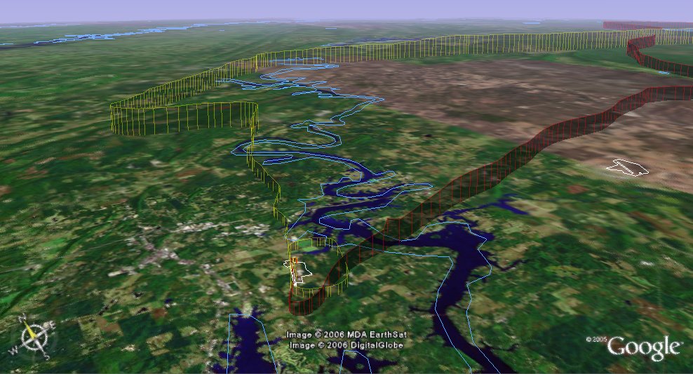
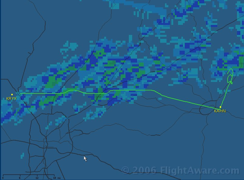
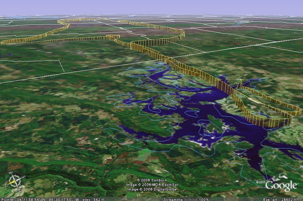
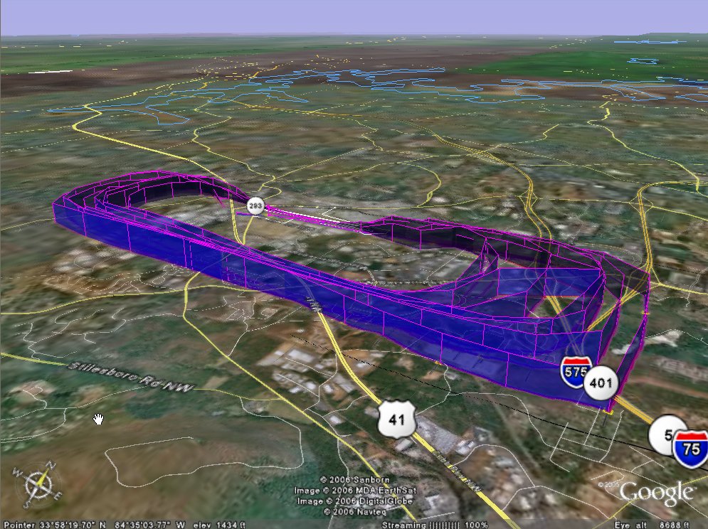
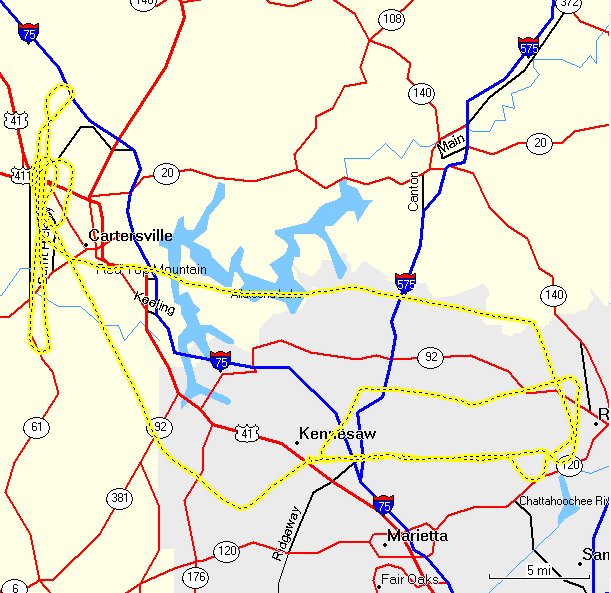
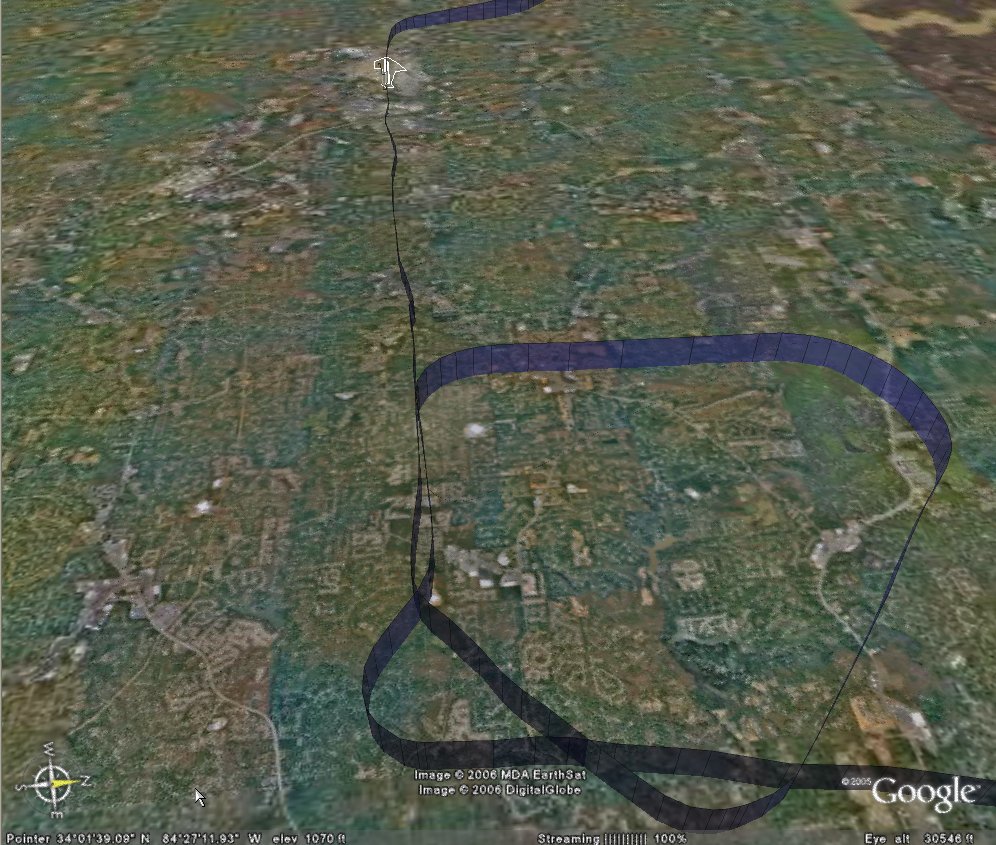
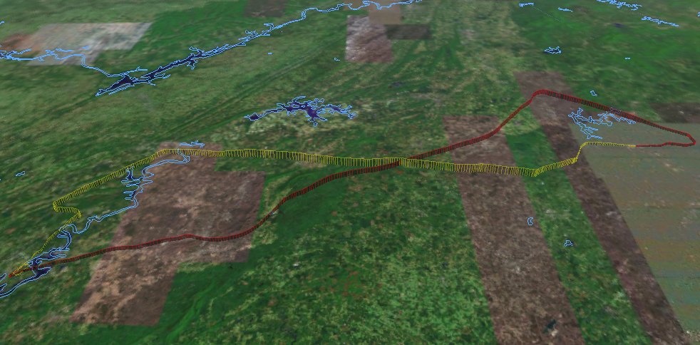
We asked for and were granted the full GPS RWY 20 approach. I put the foggles on and went through my checklists. Pretty standard fare, left 90 degree at the IAF, right 90 degree turn outside the FAF with about a 3 degree glideslope. I got down OK, but the course work was terrible. I never really captured the final approach course and struggled with large serpentine curves. (Mine is the yellow track.) Ouch. Clearly I need more practice.

There were two other planes in the pattern (uncontrolled field) including a homebuilt (Challenger?). When I took the foggles off I could see he was on final infront of us, and felt the spacing was pretty good. I misjudged how slow he was going and executed a go-around when he failed to clear the runway in time. One lap around the pattern for a nice landing at a strange field.

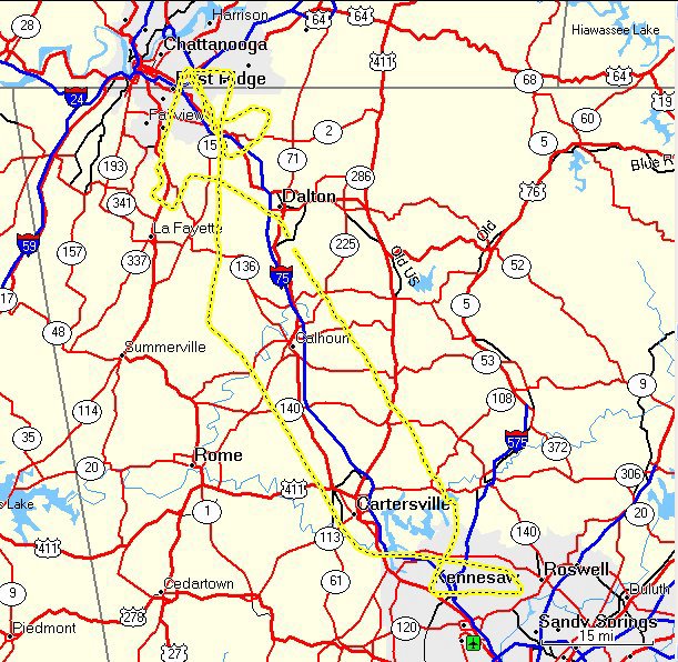
So this was a good trip out to St Clair County airport. We reached 8351 ft (Updrafts through the tops of the clouds) went 131 miles and reached a max ground speed of 141 mph.

C172p
Time = 1.8

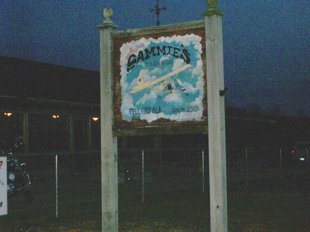
Sammie's Touch 'n Go is listed in the $100 Hamburger Guide as the best 2006 Fly-in restaurant in Alabama, and you won't get an argument from us. We called the flight school to insure no one had the airplane after us, and to let them know we would be back late. You can taxi right up on the lawn in front for place to park. It is a large 'log cabin' style building decorated with extensive aviation memorabilia. While they opened a bit late, the service was good and the hamburgers were great. Wash it down with a little "sweetea" and you're good to go. Very reasonable price (especially since my copilot paid), it earned every one of the 5 hamburger rating. I'm already looking forward to a return trip with Kathy.

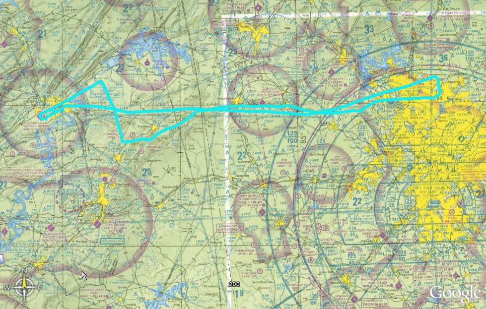
The trip home was his, night time. He called and got a Wx brief and decided to go VFR to potentially take advantage of an approach at Talladega or Anniston. The front had stalled in southeast Georgia, and there were some clouds in the area, and even forecast for possible thunderstorms there, but our route should be fine. The plan was to fly east , stay south of the restricted area (R2102-A), then head Northeast to Cartersville (VPC) and pick up vectors for the ILS 27 at home.
Startup and taxi were normal ( except going on the grass instead of asphalt until away from Sammie's) and runup was fine. We called a few times to make sure no one was on final, then taxied into position for take off. 5 clicks on the radio and the lights came on. I'm sorry, I think that is really cool and just plain beautiful!

He climbed on course up to 3500ft to the TDG VOR, staying north of the airports and checking in on the CTAF for traffic. Visibility was good and the cloud bases still seemed to be up close to 8000ft. Passing KANB we noticed a 'dark spot' off to our left, and decided to stay clear (cloud?). Turns out it was a mountain. The VFR Sectional gives the quad height of 2500, but the IFR chart showed an MEA of 4000. He decided to climb up to 5500 just to be comfortable. Lesson here is that when you feel uncomfortable, do something about it. Going to 55 was a good decision. The rest of the enroute portion of the flight was uneventful, except for the shear beauty of flying at night. I said it looked like the earth was coverd in black velvet with amber jewels sprinkled all over. "King of the world" comes to mind.

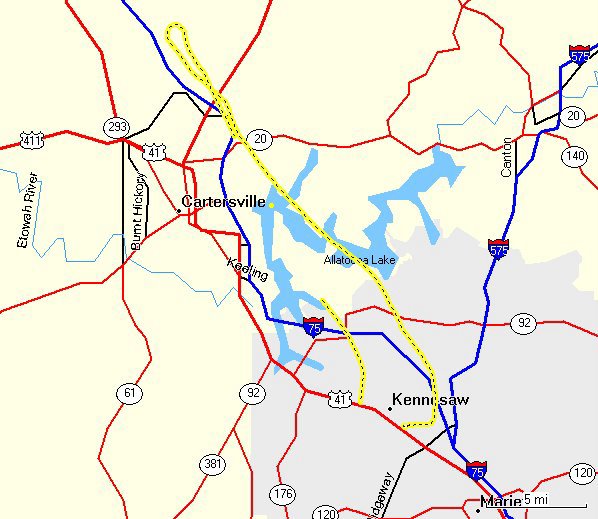
We got our squawk but had trouble staying in radar contact. So we accpted an easterly heading with hopes that ATC would pick us up in time to turn us in for the ILS. Not much traffic on a Friday night, so keeping clear of everyone was pretty easy. Sure enough, we got radar contact back prior to AKONE (FAF) and were cleared (VFR) for the approach. Unfortunately, he didn't do much better then I did (serpentine approach) but made a nice landing. 150 miles, got up to 148 mph and a max altitude of 5927 ft.

Time = 1.3

This was a GREAT training flight. Enjoyable company, fine food, and a touch of adventure. Does it get any better the that? (Doubtful)

Thursday, March 02, 2006

Gadsen, Alabama

The objective of this flight: IFR enroute procedures.

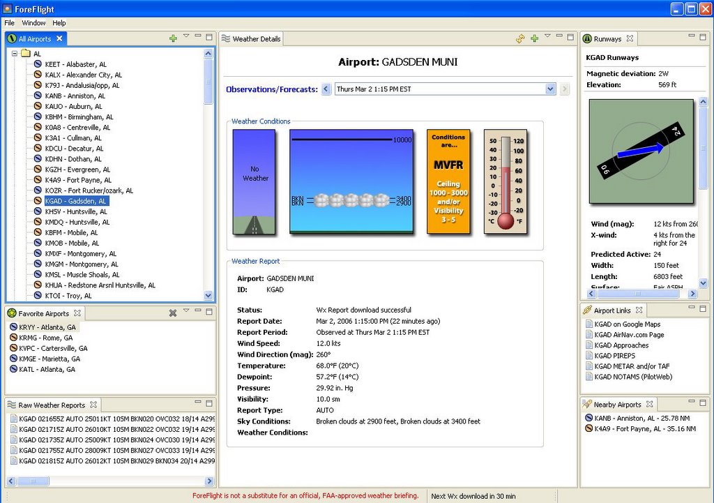
The weather was 'iffy'. A cold front was slowly moving down from the Northwest pushing some clouds and rain in front of it. We had planned to fly to KPLR for a $100 Hamburger, but low ceilings and gusty winds made the Go-No Go decision hard. My practice pilot decided to wait for a better day, and by 3:00 I had just about decided to do the same. I called local ATIS one more time and found that at least around here, conditions had improved. So, why not go out and get some actual IFR time shooting the ILS?

By the time I got to the airport, winds were still gusty, but ceilings had gone from overcast to broken. So, I filed IFR to Gadsen Muni, just a waypoint on the way to Pell City, but in the right direction. I don't have much solo IFR time, so this could be interesting. It would give me a chance to practice, as well as play with the GPS a bit (what does that OBS button really do?)

Ground work was all normal, however my clearance came back a bit different then filed. ATC wanted me to go down to HEFIN, then up V321 rather then the shorter DALAS/V325 I filed. Longer route, but I was trying to get some enroute IFR time, so no complaints. *Note: "FAA has suspended all 'position and hold' clearances until further notice." First time I heard that one. Takeoff was normal, climbed to 4000 ft, expecting 6000 in ten minutes. Radar contact, I'm cleared direct GAD. (So much for planning.) I get to punch through a few little white puffy ones before getting on top, and the weather starts getting...nice. Where's my IMC? I guess the front ran out of moisture because the clouds got thin and then vanished. Head winds at about 40 kts with a bubble here and there, but nothing extraordinary. Maybe I can log a tenth.

So I enjoy the trip. Polish airwork, play with the 430, shoot a low approach (GPS RWY 24) and head for home. Vectors for the ILS are a bit interesting as I have two twins in the row behind me so am asked to keep my speed up. a 172 can only go so fast. It turned into a nice approach (although VFR) and a sweet landing.

221 miles, with homeward winds I reached 163 mph and was above the clouds at 6053 feet. This was a good flight. Every so often its nice to spend some time alone up there.

C172p
Time = 2.3

Friday, February 17, 2006

Athens, GA


The objectives of the flight: 1) Practice Pilot for an Instrument Pilot, 2) Practice a non-precision approach, 3) go some place different.

The weather has been somewhat unstable. Ceilings and visibility are OK, but temperatures have been warm and winds gusty. Our original plan was to go west to KPLR, but after reviewing the METARS, Airmets and Pireps we decided to go east and avoid some turbulence. A series of low pressure areas and a polar cold front was slowly moving just northwest of us stirring things up.

Athens (home of UGA) is about 75 miles from McCollum so would work for his x-country time. We also planned to come back to Winder (KWDR - Spitfire Grill) switch seats, go up to Gilmer (KGVL - Lake Lanier) and finally home. This would roughly split the time and if running late, I still have my night currency.

The oil was a bit low so preflight took longer then expected. Groundwork was all normal and we took off about 4:30. Fairly good winds out of the south, but only a little turbulence. He but the foggles on and headed roughly east climbing to 5,500. Visibility was good, about 8 miles in haze. Interesting for me as we flew by a number of out lying airports a portion of metropolis Atlanta. We listened to various common traffic frequencies, tuned radios and in general practiced x-country procedures.

We immediately noticed that the GPS was setup for 'Track Up". Both of us prefer "North Up". It took me a minute to remember that this correction is found by pressing the Menu button, using the Map Options to change the settings.

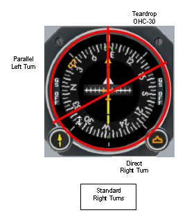
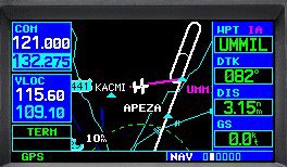
The next task was to enter holding for the RNAV20 approach. I was taught to divide the directional gyro into three quadrants. For a standard pattern (right turns), 70 degrees to the right for a teardrop entry, 110 degrees to the left for a parallel entry, and the remaining 180 degrees for a direct entry. Find the Outbound Holding Course (OHC) on the DG, see what sector its in and make the appropriate turn passing the holding fix. (Time, twist, turn, time, transition, talk). However, does GPS change this? You can see the holding pattern on the display, so is it really necessary to pass the holding fix for entry, or can you just turn onto the purple line and continue with the approach?

He completed the procedural turn (holding) and headed inbound. Athens is a towered field and there was one other plane in the pattern for Rwy27. However he was well clear by the time we passed the Final Approach Fix (FAF). The PIC started his descent late and never really got down to the MDA, so we executed a low approach, made a left turn for a downwind entry into the traffic pattern. An uneventful full stop landing allowed us to taxi over to the tower to stretch our legs and change seats.

Startup, taxi and runup were all normal. Winds had subsided so my takeoff was smooth and subsequent climb to 4000 was uneventful. However we we running a bit late so decided to forgo Gilmer and just head for home. Upon level off I contacted Atlanta approach and requested vectors to KRYY. They were not too busy, but there was another aircraft with a similar call sign. Very smooth air, but haze obscured our vision looking west and made for a beautiful sunset.

The low voltage light came on, rats. The procedure is to turn off the avionics switch and cycle the master. This plane has a digital voltage gage in addition to the discharge meter, and it showed we would lose 2 tenths of a volt, gain a tenth, etc. Slight discharge was showing. I was about 30 minutes out. hmmmm. Cycled strobes, checked breakers, no help.

Well, I decided to let it be. Monitored closely, but decided it would be OK for now. I did feel better when we called the field in sight. Contacted tower for a straight in, and made a 'squeaker' night landing.

We traveled 208 miles, climbed to 5757ft and reached 154mph over the ground.

C172p
Time = 2.3


Friday, February 10, 2006

Better Circling with Math


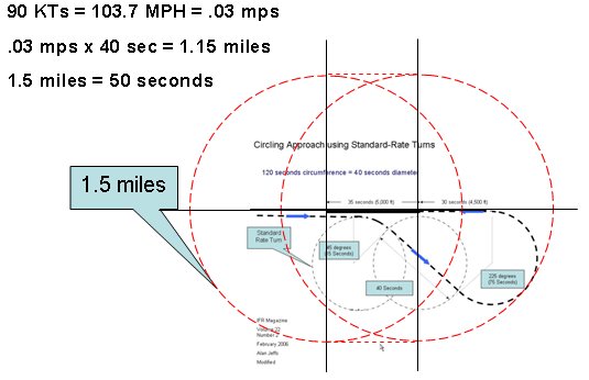
I read an article in this months IFR Magazine (Feb 06) by Alan Jeffs describing his method to determine a circling approach. I think this looks pretty good, but would like to hear from the more experienced aviators out there. (Modfications suggested by John.)

How do you do it?

Extrapolating on the theme, how about this for a VOR A type approach?


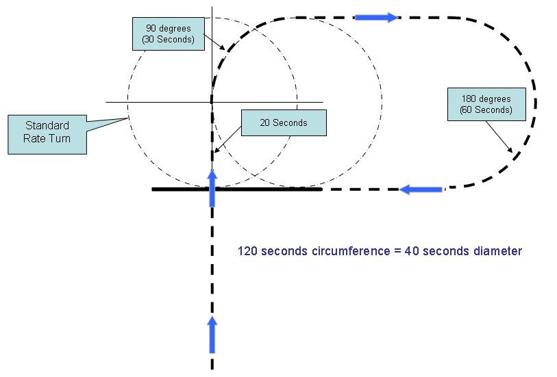
It was pointed out that staying within 1.5 miles of the airport should be a serious consideration. While not to scale, the approximate diameters indicate that this is a valid concern and should go into the planning, along with corrections for wind. (Thanks again John, for the clarification.)


Thursday, February 09, 2006

The Right Seat


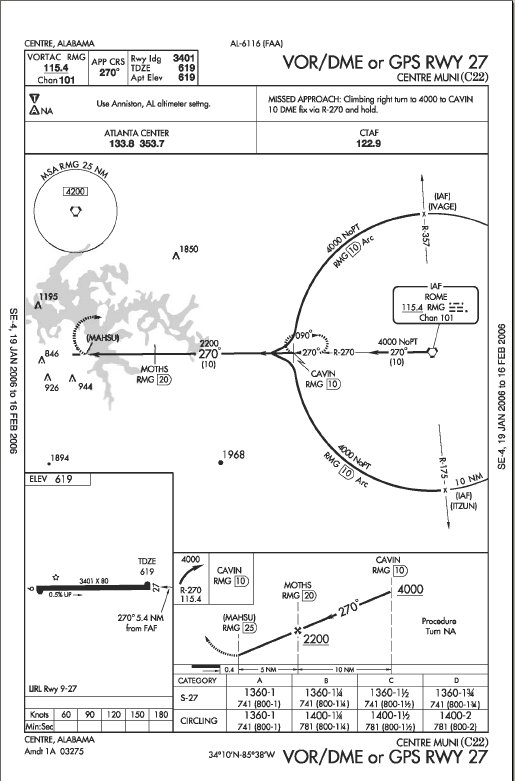
Objectives of this flight: Safety Pilot. My job was to look outside and insure we stayed clear of clouds and other aircraft. The PIC had chosen to fly to C22 (Centre Muni) in Alabama, shoot a VOR DME (arc) approach, over to Rome for the ILS 01 and then back home via vectors for the ILS27.

It was a beautiful afternoon. A high pressure area was located just west of us pushing a cold front through earlier in the morning. Good visibility, few clouds and haze, but the winds were supposedly gusting up to 18kts. Forecast said the winds would be diminishing throughout the evening.

We met in the flight office at about 3:30, briefed the flight, discussed what duties he wanted me to perform and decided a VFR flight plan would not be needed. Normal preflight, startup, taxi, and runup. A little gusty on takeoff, but not too bad, he climbed 4500 heading west. Smooth air, nicer then forecst, sun in our faces, we flew right by Cedartown (A4) while listening for traffic. The First chore was to intercept the arc at ITZUN, arc around to the west and north for the final approach course of 270 into C22. The GPS makes the arc work really simple, and he did a good job staying ahead of the needles. He had a bit of a late start on the descent, made good corrections, but still ended up high on final and decided on a low approach and go around. Full stop was uneventful. It is a nice little airport and we saw no other traffic.

All checks normal, we left there heading for Rome. He used the GPS to fly to KAREL (IAF), standard holding patten with a direct entry for the procedural turn and started inbound. A Citabria was in the pattern doing T&Gs, so my job got a bit busier. We spotted each other in plenty of time and he graciously took interval on us as we went down to mins and executed the missed back to the RMG VOR.

Next job was to get radar vectors for the ILS back home. Atlanta approach was busy. It took a few minutes, but we finally got our squawk. There was at least one other aircraft with a similar call sign, so we both had to listen carefully for instructions. We decided it would be best for him to take off the foggles to give us another pair of eyeballs looking for traffic. Also, the sun was at a low angle and the haze was thick enough to really obscure everything when looking west. It was a tight approach, final vectors called for a sharp turn to capture the final approach course just at AKONE (Final Approach Fix). He did well keeping up with it, made a nice approach and a beautiful landing.

What a great way to spend an afternoon! We went 194 miles, reached 148 mph and climbed up to 4613 ft.


C172P
Time = 2.1

Thursday, January 26, 2006

Into the Class B

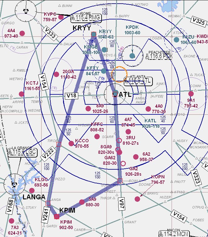
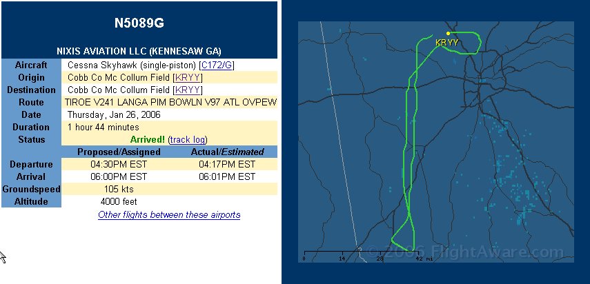
Objective of this flight: Get away from the patch and work the system. The plan was to fly down to Pine Mountain (Calloway Gardens) KPIM, shoot a GPS approach, come home over Atlanta for ILS 27 at McCollum (KRYY). We used to call them TCAs (upside down wedding cakes) reserved for the busiest of airports. While I've worked with Atlanta Center many times, this would be my first venture into the crowded airspace all by myself.

All the planning was done at home, my first time filing a flight plan from my home office. Weather was perfect VFR, not a cloud in the sky and very light winds. I got to airport just before 4:00, got the dispatch kit and went out to preflight. I had planned a 2130z departure, so had plenty of time to set up the radios. I expected a far different clearance from the one filed, so prepared myself to make the changes. To my surprise, I was cleared as filed, fly heading 260, climb and maintain 3000, expect 4000 ten minutes after. Cool.

Taxi, runup and takeoff were all normal. switched to departure, hit the ident button and waited. He was busy, but I always wonder how long to wait before reminding ATC that I'm waiting for radar contact. When he did contact me he had me turn to 180 and told me I would be on vectors down to PIM. (So much for the flight plan.)

This is GREAT stuff! Flying alone in Class B, talking to controllers, watching for traffic, just doing all of the 'stuff' I've been training to do.

I planned to do the GPS-A at PIM, which has an initial approach fix called JUKRU. I got a late frequency change and was passing the fix by the time Approach figured out what I wanted to do. No problem, I responded by going direct CARVA (Final Approach Fix) and playing the GPS to make it all happen. No problem on a clear day like this, I had the field in sight early and could easily have made the landing. Missed there and headed for home.

Again, the filed flight plan wouldn't work. Center didn't want me to fly directly over Hartsfield so I was told to go direct MIKEE. Ah, nice to have the GPS now, much easier to dial it in rather then find the defining navaids, set the radials and determine the correct intercept. A few minutes later I'm given vectors again, fly 360.

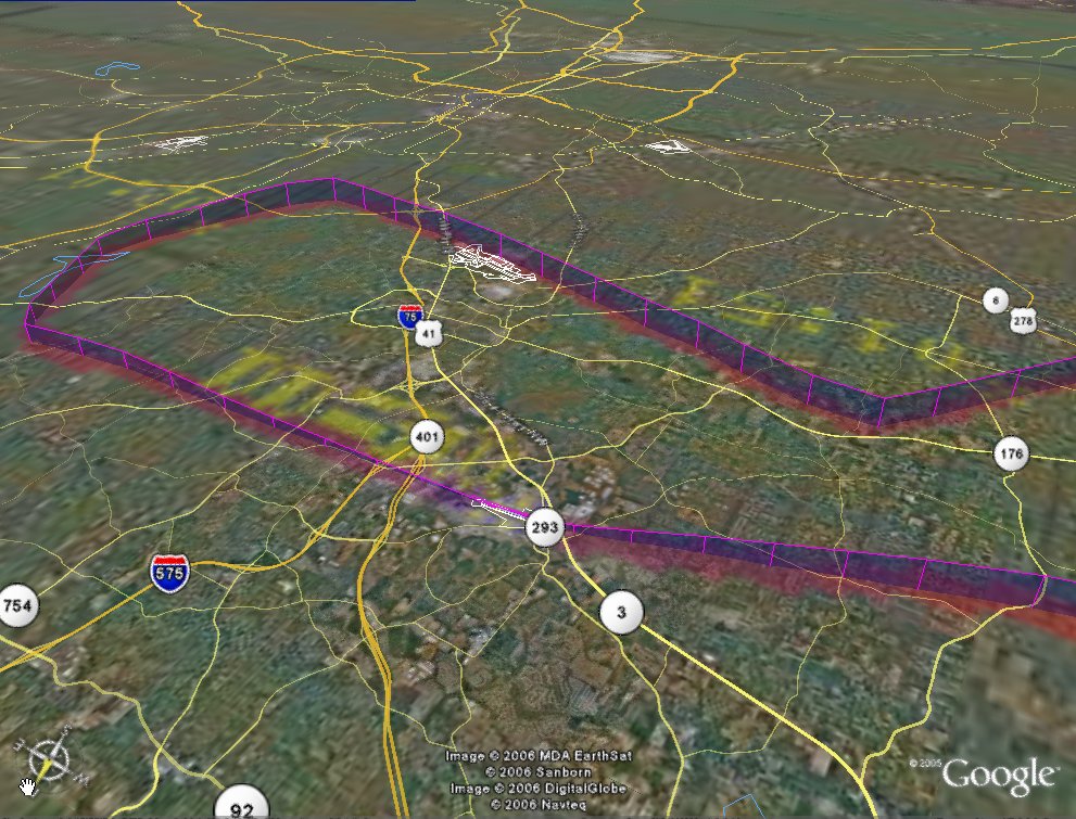
I asked for and was granted vectors for the ILS. Now this was really nice, as it took me directly over Dobbins AFB and close to downtown Atlanta. Very Cool! The rest of the approach and landing was uneventful. (Really easy when you can see the runway.) 215 miles, 5,090 feet and a max ground speed of 152 mph.

C172P
Time = 2.2 hrs

Thursday, January 19, 2006

Local Area Bounce

Objectives of this flight: Shoot some Touch and Goes. Instrument flying has been great, but my first love in aviation has always been the landings. That sweet squeak when the mains just kiss the asphalt and you feel the struts gently contract... well, if you don't know I can't explain it to you.

It's the middle of January and the temperature is in the mid 60's, clear as it gets and I have some money in my 'prepay' account. Got to the airport about 4:00. My CFI is sitting in lounge waiting for another student and asks where I'm going. After all this time and effort to get my Instrument ticket back, its hard to believe that I just want to go out and bounce.

Normal preflight, taxi and runup. Its busy today and I have to wait a few minutes before cleared for takeoff. The plane jumps into the air when no one is in the right seat. It has been awhile, no climb checklist since I'm staying in the pattern. (What are my settings and speeds?) It all comes back quickly. Tower calls, looking for traffic and making appropriate corrections for spacing comes easily now.

8 total, 4 good (3 great), 4 "OK" (1 salvaged...balloon), full flaps, half flaps, No flaps, and all with a mild (6-8kt) left crosswind. I had a smile on my face the whole time. "Peaceful", "At Home", "Comfortable" is how I would describe it.

Next time I'll have to wander away from the patch and go explore something, but today was a good day just to bounce.

C172P
Time = 1.1

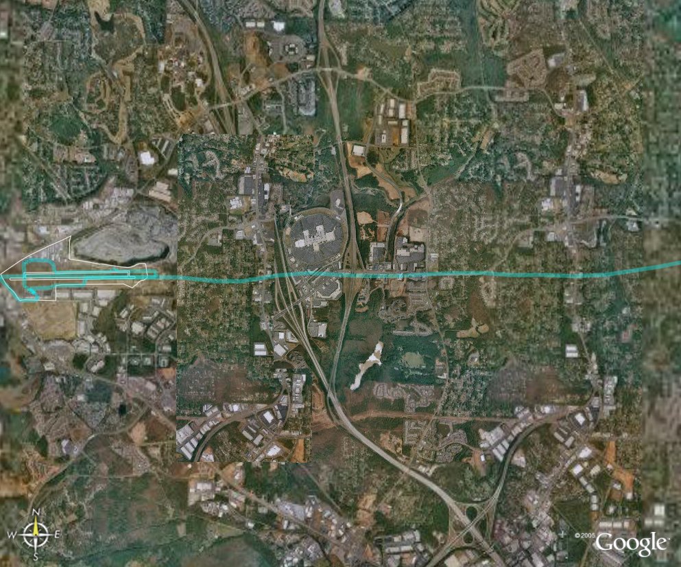
*the track was created using Magnalox. (#1152 'Local Bounce'.)

Thursday, January 12, 2006

IPC


I had a personal accomplishment last evening. I completed my IPC (Instrument Proficiency Check) and am now allowed by the Federal Government (FAA) to fly in clouds. I can now use the radar systems of the United States (ATC), fly on designated airways and execute standard approach procedures into airports. I've always felt that the Instrument Rating was the most difficult one to get, and am pleased to have these privileges reinstated.


I arrived at the airport about 4:00 PM local, had a short brief with the CFI , grabbed the dispatch kit and went out to start the preflight. The cold front that passed through with such energy in the morning, had left behind a beautiful blue sky and unusually mild temperatures (65F). The preflight was normal (although getting up to check the fuel level with my 'bum' leg was a bit difficult.) All checks complete, I got to the point where you turn the key and....nothing. Dead battery. I don't believe in 'bad omens' but this was not an auspicious start. Fortunately another C172 (w/Garmin 430) was available so we jumped over to that one.

Taxi was a bit unusual as some paperwork needed to be delivered to the maintenance shop on the north side of the field. This was my first time over there in an airplane, but no big deal. The nice thing is, they have a 'formal' run-up
area, felt almost professional to have a space to do this other then a taxi way.

The plan was to fly north up to Calhoun, do a 'mystery' approach somewhere, and come home with the ILS. I took my time and used AMICEATM to get set for the approach. Weather is obtained from CTAF, or use the Rome altimeter settings. The Rome frequency is not listed on the approach plate, so I used the GPS nearest function to get the frequency. I fumbled a bit getting GPS back to the approach, but no major errors. The clock was broken in the airplane, so I used a combination wristwatch and Westclok for the timings. Overall, the approach went well. There were strong crosswinds but I was able to keep the needle alive. I executed the missed there and headed for the holding pattern.

The intent of the 'mystery approach' was to have me control the airplane while reaching back for my approach plates, leaf through the binder to find the right approach, brief it, set up the radios and execute it. This simulates a contingency situation, the kind of thing that happens when for whatever reason, the planned approach doesn't work.

Key here is scan. Flying the airplane while searching for the approach is cumbersome, but good trim and constant scan make it doable. He chose the GPS RWY 34 at Pickens County (which can be found under Jasper). While I could easily dial in the GPS, I needed the approach plate to determine the closest IAF. The rest of the approach was normal, except that the last pilot had set the GPS for 'airplane up' instead of 'north up' which is my preference. I got
slightly confused on the first turn as I tried to transition form the screen to the plate. (Later, we changed the preference.) The rest of the approach was uneventful. Missed there and headed for home. By this time it was getting dark, and it was nice to find that the panel lights worked! (I still had my flashlight at the ready.)

Climbed to 3000, headed roughly south and listend to ATIS for KRYY. I contacted Atlanta Approach and requested
vectors for ILS 27. No problems. I was 'on rails' until the end where I zigged to the left a bit. Overall a very good approach and nice landing.

Assessment: The most challenging (and interesting) part of this 're-training' was the use of GPS. Tuning in and flying the needles came back rather quickly. However, adding the 'TV Set' into the scan, and prioritizing it properly was much more difficult then expected. Once I learned to relegate it to a secondary system, I did much better. (I spent far too much time trying to tune the GPS, when I could have accomplished the same thing by twisting a radio knob.) There is no question that the situational awareness provided is simply wonderful, but the other aspects of Aviate - Navigate - Communicate can not be sacrificed for that extra bit of added awareness.

C172P
Time = 1.7

Friday, December 23, 2005

Accounting

It's that time of year, to look back and see what objectives were planned and how effective was I at accomplishing them.

First, I had no plans to start flying again this year. Life was/is still much too hectic for me to engage in another (very expensive time consuming) hobby. So any progress in this area has to be considered a positive. Once I decided to get involved, I had just three objectives: 1) Pass my medical. 2) Pass my Biannual Flight Review for Private Pilot. 3) Fly at least once a week. I planned to start on Instrument Proficiency next year (first half) and perhaps CFI after that.

So, results:
1) I scheduled and passed my 3rd class medical in March. The only restriction is I must wear glasses when I fly.
2) I researched the local area for flight schools. Assessed what I wanted to get out of the training, interviewed some instructors in March and April. I took my first flight in mid-April. I passed the BFR and soloed by the end of May. (Got checked out in a Tiger, then a Warrior, and finally the 'high wing wonder'.)
3) I started flying with 37 weeks left in 2005, I finished the year last night with just over 38 hours. Unfortunately it wasn't every week, but the intent was there.

In addition, I've worked hard on my instrument skills and am getting close to completing the IPC. CFI is still something to consider for next year. (Tailwheel endorsement, Complex a/c)

I underestimated the amount of study required. Books include: Rod Machado's Private Pilot Handbook and Instrument Survival Guide, FAR-AIM, Hayes's Instrument Oral Exam Guide, Eckalbar's IFR: Structured Approach. Various magazines, and of course web sites were all used to get back up to speed. (BTW, I didn't know what a Blog was last year. Podcast?) I also use Microsoft Flight Simulator and the Garmin 430 Simulator.

I also underestimated the 'flight bag'. Headsets (need one for a passenger too), charts, plates, and gadgets like GPS and Transceiver (not needed but definitely nice to have), and other assorted pieces of gear.

So, what about the cost? Roughly twice what I estimated (but then I got further along then initially planned). As my wife said last night "Not a bad investment."

Thursday, December 22, 2005

My Christmas Present


The objectives of this flight: Enjoy.

After all this time, I finally had a chance to fly with Mandy. The weather was great, a bit hazy but ATIS was calling it 10 miles. No clouds and only light winds from the west.

We started the preflight at about 4:30. I carefully explained each step of the procedure, pointing out what I was looking for and why it was important. Same thing once we sat in the cockpit. Gave it some time to sink in, allowed her to ask some questions, and tried to prepare her for what to expect. No surprises. Start, taxi and run up were all normal. Take off was as well, except for her gasps of excitement!

Very smooth air. Climbed to 4500 to get above the haze layer, trimmed it up and let he have the controls. Slow easy turns made easy by the sharp horizontal line caused by the haze. Talked just a little about lift, and why back pressure was needed in a turn. Then I gave some headings to fly, which she did quite well. No problems with airsickness, sinus problems or other distractions. So we flew south for a bit, to enter the pattern from the southwest, hopefully flying over our house. Pretty close, and we did identify our development, but not the house.
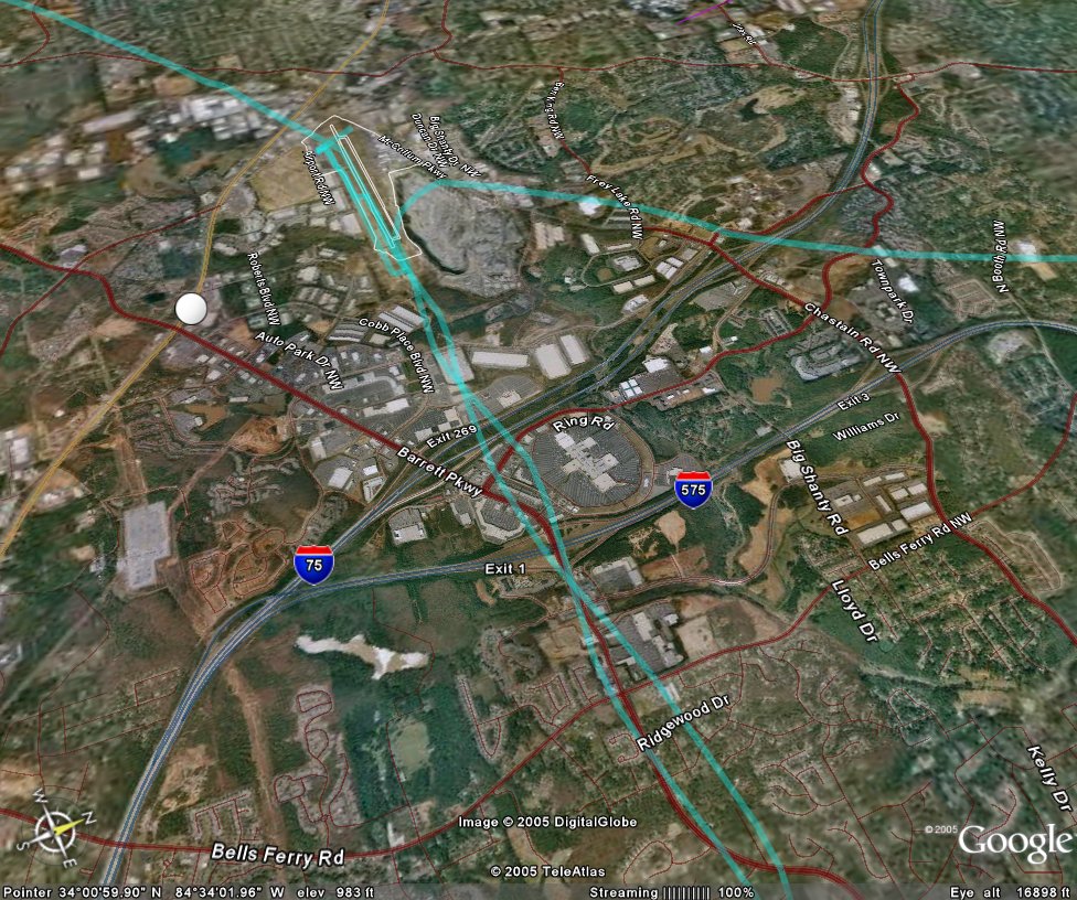
The haze mixed with the low light from the setting sun made very poor visibility. Tower was calling traffic within 3 miles that I couldn't see until behind my wing. Navigation lights and beacons just seemed to be a part of the traffic lights below. Entered left traffic number 2 behind a Piper on a right downwind. I was able to pick him up after a few tower calls, and extended the pattern just bit to follow him in.

Checklist complete, on speed, on altitude and the air is smooth as silk. Over the Mall on final, the Piper cleared the runway and it was my turn. Good landing.

"When can we do this again? I mean really?"

Does it get any better then that?

We traveled just 75.4 miles, climbed up to 4627 feet and reached the awesome speed of 135 MPH. What a beautiful night.

C172P
Time = 1.2

Wednesday, December 21, 2005

IFR 10 - IPC (almost)


The objectives of this flight: The Instrument Proficiency Check. I planned the same route as last time, up to Rome, over to Cartersville, and back home. Weather looked good (a little gusty out of the NW, but not bad). Sky as clear as it gets.

However, it was a bit cold, so I got some hands on training on how to use the engine heater. The briefing and preflight were normal. Engine started well (no prime required). Taxi and run up without any problems. Took off to the west and put on the foggles, climbed to 4500.

Radio setup went well. RMG VOR in Nav2, RMG ILS in Nav1, GPS backing up our track to Rome. AMICEATM went fine. We discussed holding entry, and noted on my last flight I entered direct and typically this is a parallel entry. (I pointed out that my heading was 'all over the place due to poor airmanship setting up the GPS, so a direct entry was correct at the time.) Station passage, outbound to the entry, just waiting for the ILS to center. Did not happen, so I used the GPS (which recommended a direct entry) to establish myself outbound. Ahah, ILS still in standby, push the switch and all is ok. (Identify means to actually listen to the dit dah!) ouch

The rest of the approach was fine, down to mins, and could have made the landing. Missed back to the VOR. Nice to have RMG in Nav2 so that I can set up for Cartersville with the GPS. I had selected the Loc like before, but decided to do the VOR A /GPS. This would give me the 'circle to land' approach needed. (Besides I had blown this on IFR 2, so wanted to do it right.) It is an interesting step down approach that takes you right by the cooling towers (1720 ft) at Cartersville. The CFI let me take a peak to underscore the reason for the altitude restrictions. The last step is pretty steep (2200 to 1560 in 1.6 miles). I got to mins, took the foggles off and did a nice circle to land on Rwy 1 (smooth landing).

Cleaned up, climbed out and headed back home. Unfortunately the transponder acted up and we were unable to get vectors for the ILS. We stayed VFR and the CFI provided the vectors needed. More then normal s-corrections, bobbing on GS was not pretty, but not pegged either. (I almost went missed at the Loc mins again.) It was an OK landing.

So, improvement over the last few flights. Airwork is ok, headwork improving. One more flight into a 'strange airport', an "unplanned approach" and maybe some more partial panel work should convince us both that I am ready.

This was a good flight, it should have been great. I know what to do, how to do it, and know when things aren't right, but I'm still not executing to the best of my ability. I'm really looking forward to the next flight.

Focus on the journey, not the destination.

C172p
Time = 1.5

Monday, December 12, 2005

IFR 9 - More Practice


The objectives of this flight: 1)Build Confidence, 2) Practice procedures.


I linked up with a safety pilot for this flight, another private pilot working on his Instrument rating. His job is to look outside for traffic while I wear the foggles and look inside at the instruments.

My plan was to fly VFR direct to the Rome VOR, do the the ILS into Russel (RMG), then right over to Cartersville for the Localizer, then back home and ask for vectors to the ILS at Cobb County.

KRMG 121853Z AUTO 29013G21KT 10SM CLR 13/M01 A2990

KRYY 121845Z 29015G21KT 10SM FEW030 12/M01 A2988

The weather was finally good, although gusting winds to 21 knots would make it interesting. I didn't file a flight plan as most of the work would be around non-controlled fields. The brief, preflight and taxi all went well. It is a little different being in the plane without an instructor, more personal responsibility, less effort to impress. I just felt more comfortable. The safety pilot pointed out things he does a bit different, I shared my procedures, and overall it was a very good 'give and take'. Low voltage light during run-up, avionics off (GPS flight plan lost), master reset, voltage OK.

After we cleared Cobb County airspace I put the foggles on and set up to track inbound to the VOR. Along the way I set up the radios, listened for weather, listened to and advised Rome traffic and generally completed all of AMICEATM. I used the GPS as backup and rediscovered my tendency to apply yoke pressure when fiddling with the GPS. I'm just going to have to put my left hand in my lap when I tune that thing. Otherwise my air work was acceptable, though far from my best.

The ILS uses a holding pattern for the procedure turn, the IAF is defined by the inbound course on the Localizer(Nav 1) and a radial from the RMG VOR (Nav 2). My radio setup was good, and it was nice to have GPS setup as backup and situational awareness. (BTW, approach plates are much easier to read in the daytime.) Gusty winds pushed me around a bit, but I felt very comfortable with the approach. Went to mins and executed the missed back to the VOR.

Since I was tracking with Nav 2, it gave me the opportunity to set up Nav 1 for the next approach. Again, I backed this up with the GPS (careful to scan and not push while tuning in the new procedure). Cartersville had touch and go traffic on the opposing runway, so we stayed at altitude for this one. (Again, I was really interested in procedures, so going down to mins wasn't essential.) Normal procedural turn, intercepted the Loc inbound without any problems, took the foggles off so two sets of eyeballs could look out for traffic. Went missed and told the boys in the pattern I would get out of their way.

Heading east, the setting sun shining on Atlanta was beautiful. City lights were coming on and the traffic jams coming north made me delighted to be in the sky. I contacted approach to see if they could fit me in for vectors to the ILS back home. It must have been a slow night since he gave me a squawk, told me to stay VFR and gave me the vectors I requested. Foggles back on, checklists complete for a beautiful ILS. Foggles off a little above mins, I saw I had maybe 20 degrees crab into the wind so decided to use just 10 degrees of flaps and fly it a little fast. Landing was not my best, but respectable.

Fun! This was a fun flight. I did all of the things I needed to do, found some inherent weakness in my personal routine that can be corrected, and made a new friend at the same time. We traveled 155 miles, got up to 155 mph and climbed all the way up to 3907 feet. (Scattered clouds at 4500 kept us down around 3000 for most of the flight.)

C172p
Time = 1.7

Thursday, December 01, 2005

IFR 8 - Practice, Practice, ...


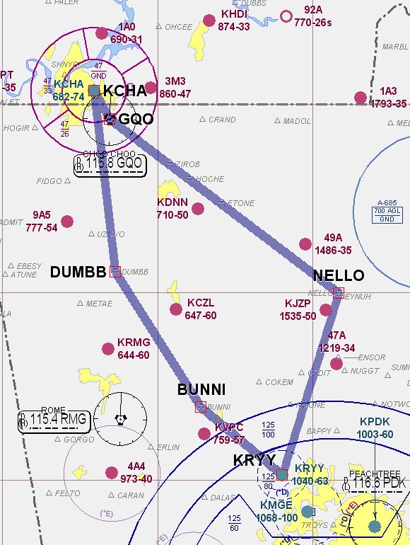
The objectives of this flight: Practice. I filed a flight plan to Chattanooga via airways. I planned to do an ILS followed by VOR/DME arc then back home via standard arrival and a GPS.

The planning, preflight and takeoff were all normal. We were cleared as filed, which took us to Nello Intersection then V5 into CQO (Choo Choo) for the approaches at KCHA. Two weeks since the last flight, I was a little rusty, or at least not as sharp as I would like. I had to work to track the course, maintain altitude and make the radio calls. The course deviation never got close to pegged, but it was seldom in the donut either.

CHA was pretty busy and I had vectors for spacing before getting on the approach. I was slow to flip the LOC frequency from standby to active and had a difficult time reading the minimums for the approach. (I discovered something here. I've been using a red LED flashlight for my night flying. For whatever reason, when I use that I can't quite focus on the approach plates. Using a standard red flashlight works better for me.) Good course and glideslope, but I missed at the Localizer mins instead of the ILS. (Dummy)

OK, so executed the missed approach and went for the VOR arc. Osily (IAF) is 7 miles out on the 090 radial, and you arc to the south for a 332 final approach course. Winds were quite strong out of the west, so I used a 20 degree cut instead of the normal 10. It worked well. Course control on final was good. Missed there and turned for home.

The air was much smoother on the way home. Basic air work was much better. I asked for and was given the Bunni Two Standard Arrival (STAR), which took us right by RYY. The GPS 27 was good with a nice landing.

Overall it was an OK flight. I was not happy with my air work. It was a good training flight. Nice to go somewhere different, and a great opportunity to review cross country procedures. A little more practice and I should be ready for the IPC.

251 miles round trip, 5047 feet (always just a bit off), and with the tailwind on the way home we got up to 172 mph.

Cessna 172p
Time = 2.6

Friday, November 18, 2005

IFR 7 - Just one of those nights


The objective of this flight: 1) Practice and review. I wanted to get some ground school done, primarily to review Federal Aviation Regulations (FAR Part 91), Aeronautical (Airman's) Information Manual, and Low Altitude Charts and Approach Plates. After that, I wanted to fly a few ILS approaches just for 'polish'. I'm feeling comfortable now, and just wanted to finish off any items prior to the IPC (Instrument Proficiency Check).

The briefing went well. My study of the manuals paid off, and I reviewed the DVD from Sporty's on the IPC. No questions surprised me, and we discussed common sense, practical airmanship as well as what is in the book. (Knowing that you are going into real IMC conditions, what is your minimum equipment list for a Cessna 172?) I missed a lot of questions on the low altitude charts. Everything is on the legend, and I could easily find it there, but probably a good idea not to be searching a legend on the other side of a chart while bouncing around IFR. So, I need to look over that some more.

Question: Is it legal to download approach plates from AOPA or AirNav (or other WWW sources) for use in actual IFR conditions?

We decide to try a PAR into Dobbins AFB. I hadn't done one of those in XX years, so thought it might be fun. Then try some ILS approaches back home and call it a night. KRYY is Notam'd for runway closure at 10:00 PM (local) for repairs, so we need to be back home before then.

So I go out to preflight and it is cold! My planning METAR looked like this, and by 2300Z it was colder:

KRYY 172045Z 34012G18KT 10SM SKC 07/M09

The first really dumb thing; "Normally" I take the key from the dispatch kit and put it on the glare shield. That way it is visible to any maintenance guys, or others walking around the airplane so that they know the twirly thing in the front isn't going to start moving. This time I put it in my jacket pocket. When I removed the pitot cover I put that in the same pocket. Back in the plane, I put the pitot cover in the dispatch kit (so I wouldn't forget about it and take it home with me.) When I got to the START Checklist we spent a good 10 minutes looking for the darn key. It was in the dispatch kit tangled in the flag of the pitot cover.

The rest of the ground procedures were normal. Take off a little squirely due to winds. Contacted Dobbins and found out they don't accept practice PARs for security reasons. OK, I can understand that, but its too bad.

Plan B: My instructor would like to shoot an approach and asks if I would mind being his safety pilot. GREAT! An education in itself watching his setup and execution. It really helps to drive home all of the tips and techniques he taught me, by seeing him using them to such good effect.

After he gets done, its my turn. Foggles on, approach plate ready, time for the ILS 27 at RYY. He asks me to contact ATC and request the approach. This is easy now, and all communications go well. (BTW, it really does help to have an active noise canceling headset.) Radar contact, on vectors for the approach. AMICEATM

Second really dumb thing: The 'C' in the gouge is for Course. I missed it. I checked it on the approach plate but never dialed it into the CDI. So I'm happily plowing along on vectors, "Cessna 361 turn right heading 240 intercept the final approach course you're cleared for the approach". Course deviation for the Localizer is alive, I turn to....the course from the previous approach, 183. CFI says I'm confused. Center says I'm well south of approach course and asks if I need vectors back. The light bulb comes on. "Center, 361, no thank you sir, I can find it." 30+ correction back to course and by this time the Glide slope is coming alive and the course needle is unpegged. "361 remain VFR, switch to tower Frequency." I'm scrambling. Aviate, Navigate, Communicate. Come left to final approach course, power off to start descent, did I miss anything else? Punch the button to bring up Tower. "Tower, Cessna 361 is with you at AKONE (FAF) ILS RWY 27 with information November. 361 Tower, what are your intentions following this approach? 361 will execute a missed approach for another ILS 27. 361 what are your missed approach instructions?" What, is he testing me too? OK, I know this; "Tower 361 will turn right 030 climb to 3000 feet and contact Approach on 121.0" It was not a test, evidently ATC had never made the complete hand off to Tower.

OK, so that one was ugly. CFI asks if I want to try to redeem myself. Redemption is a good thing. Next one goes OK. A little chasing at the end, I think due to winds, but definitely would have been able to land from real IMC.

Humility is a good thing. Just about the time you think you have this stuff wired, you get a 2x4 to the side of your head. Bad flight, GREAT(!) training flight. We covered 146 miles, reached 143 MPH and an altitude of 4448 feet.

Cessna 172P
Time = 1.2

Saturday, November 12, 2005

Autumn Color

The objective of this flight was very easy: 1) Go north to the Georgia mountains and see the fall colors. N53361 is in for an annual inspection, so I got switched to N737SA, another 172P but without a GPS. It was definitely not required for this flight. Nate called from Cedartown, he had just finished sky diving and wondered if we could pick him up. I was sure that with full tanks, the three of us, and his gear, that the weight and balance numbers wouldn't work.

We were a little late getting to the airport, and as it turned out, the plane needed gas which got us out later then I had wanted. Preflight was normal, but the radio stack was a little different so it took me some time to figure out how to set the frequencies needed for ATIS, ground and tower. The air temperature was a little cooler today, mid 60's, and clear blue sky. Taxi and runup normal, and I decided to let Kathy try a take off. Smooth power, a little rough on the rudder and nice take off attitude. Pretty good for her first attempt. We departed to the north at 2500 feet roughly following I75.

There wasn't as much color as I had hoped for. Maybe because of the low angle of the sun, but the trees were mostly brown and green, not the oranges, reds and yellows I had expected. I let her fly most of the time, no problems encountered. After about twenty minutes she did a 180 and we headed for home. The setting sun illuminated the glass buildings in Atlanta making them seem almost on fire. Entered the pattern on an extended left base and finished with a beautiful landing.

The Flying club was having a Turkey Fry, so we met with Nate for a great dinner. My kind of ambiance, sitting in a hanger watching airplanes land.


The 96c is working better, but still didn't get a complete track.

C172p
Time = 0.7

Thursday, November 03, 2005

IFR 6 - Communicate

The objectives of this flight were pretty simple, 1) Work with ATC. This time I checked the winds BEFORE chosing what approaches I would try. The GPS arc at LZU still looked interesting, and an ILS is always fun, and back home I could do a simple GPS.

Th flight plan looked like this: Depart KRYY then JOXUV KLZU FLANC KFTY UPHAH then back to KRYY. JOXUV, FLANC and UPHAH are initial approach fixes for what I had chosen.

Brief, preflight, and clearance delivery went fine. The interior lights are still a problem, so we broke out the flashlights again. I was cleared Radar Vectors as filed, climb and maintain 3000. Take off went fine, on with the foggles!

The first approach was the GPS RWY 7 at Briscoe Field (LZU). Radar Vectors means just that, we went well past JOXUV before getting cleared back to it due to heavy traffic. No problem though. What happens when you pass JOXUV and start the arc? Distance will be to the next waypoint, not the center of the arc (in this case PDK). MSG tells you to update course, and if you fly that course it pretty much keeps you on the arc, neat! Not so neat is pushing the OBS instead of the MSG button halfway through, because that suspends the procedure. To correct, go to the Flight Plan page, select the arc and enter. Presto, back on the approach. (BTW, using a flashlight to find little GPS buttons while looking through foggles and bifocals at night is a real trick.) The rest of the approach was routine, missed there and headed toward FLANC.


Well, kinda, because I was still on vectors. It gave me plenty of time to set up for the ILS RWY 8 at Charlie Brown (FTY). I learned something here too. Even though trimmed up nicely, I lost about 150 ft while doing 'A mice ATM' for the next approach. While distracted I had a tendency to gently push on the yoke (positive contact - lesson learned; adjust scan and don't push). The other 'gotcha' is what Linda addressed in her blog. "I have finally resorted to teaching the acronym TITS -- standing for Tune, Identify, Twist (the OBS)and Select the source of input data". I decided to include it under my identify step in 'mice', but the point is, you must know what source is driving the navigation head. I still had it set for GPS and needed to switch it over to VLOC for the ILS approach.

OK, nothing tricky here, just follow the instructions and get vectored around to the final approach course (082). Once headed south the CFII pulled out the instrument covers for partial panel. OK, the key here is to remember timing. Approach vectored us to 140. (180 -140 = 40 or about 15 seconds. Check compass. Pretty close!) "Come left heading 120 intercept final approach course you're cleared for the approach." (140 - 120 = 20 or about 10 seconds. Not bad.) The needles are alive! (120 - 82 = 38 or about 15 seconds. Pause and see what the needle says.) Right of course, turn left count 1, 2, 3 stop turn, wait. Right of course, on glidepath reduce power to 1700 RPM turn left count 1, 2, 3 stop turn, wait. On glidepath and the needle is coming back in for course. Hold wings level wait.....wait...Above glidepath left of course, speed is slow, lower nose back to 90 knots, right turn count 1, 2, 3 wait. On glidepath on course, wait... wait, above glidepath on course, reduce power 100 RPM wait. On speed above glidepath take off another 100 RPM wait. Needle stopped moving but not coming back, another 100 off, right of course, turn left count 1, 2, 3 wings level, wait. Decision height execute missed approach, turn left heading 300 climb to 3000. OK, now what is the math? (Target heading minus Final approach course is 300 - 082 = 140 or about 45 second)...did you start the clock, yep. Nailed it!

Vectors for the GPS RWY 9 back home was uneventful. Took the foggels off at mins, slightly left of centerline. And oh, what a beautiful landing!

Great flight. I was especially pleased with the approach at LZU, since it taught so much about the Garmin 430. I'm getting very comfortable with this now.

The 96c failed to provide a track again. I'll put it on the glare shield next time.

172p
Time = 2.0